
下载App
资质规则
旅行
账户

MarnetteS
Dappled Sunlight and Red Blazes
Flat Island Preserve的点评
点评:I read about the Flat Island Preserve in a local newspaper, described as a local place to train for long hikes in woods and trails. We live near Leesburg, FL and the idea of walking in a quiet preserve in the middle of a city was interesting to us. Off we went.
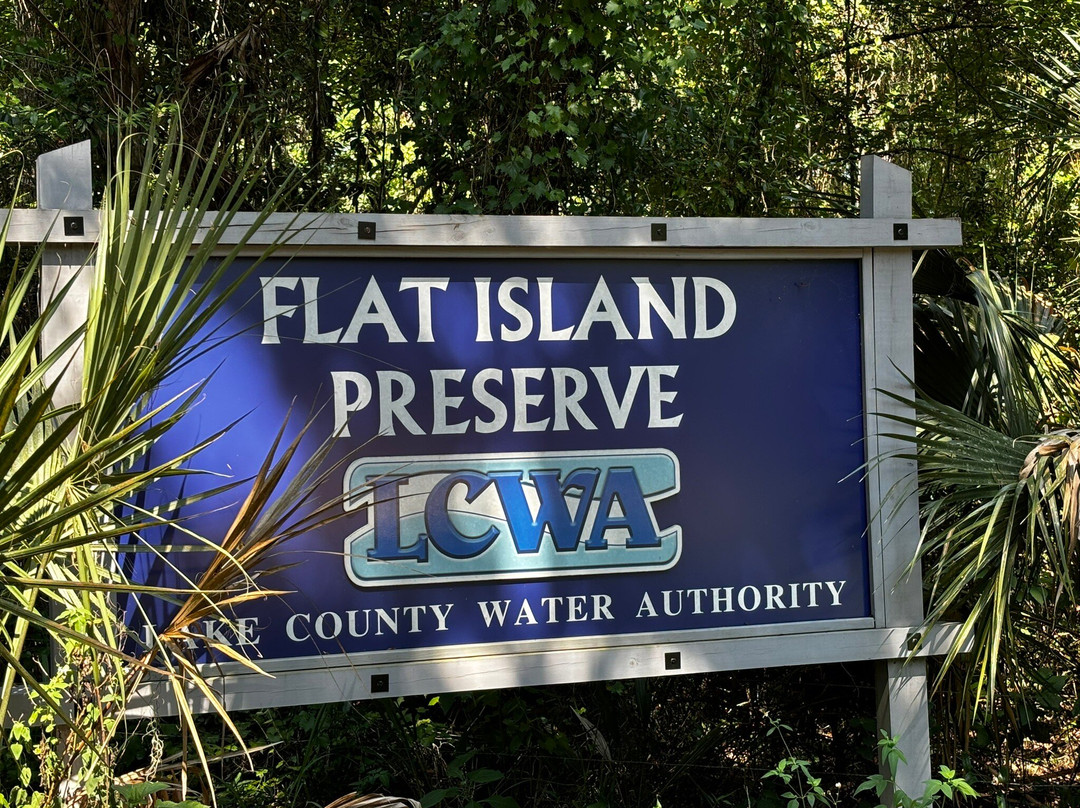
Located in Lake County off of Highway 27 in southwest Leesburg just north of Lake Denham, the preserve is maintained by the Lake County Water Authority which has preserved two wooded islands: Flat Island and Magnolia Island and the wetlands that surround them. The islands are known as Okahumpka Marsh which feeds the most important source of underground water in the state: the Floridian Aquifer.
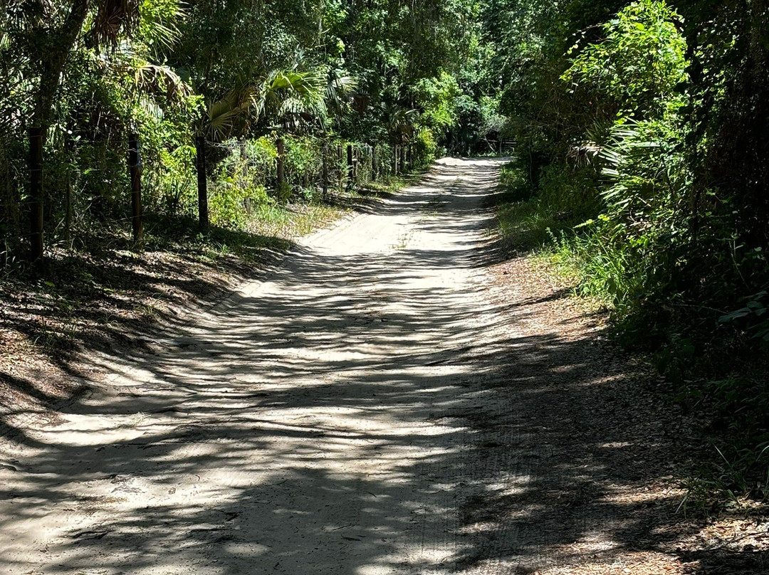
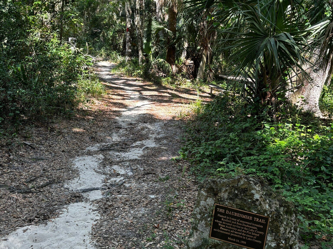
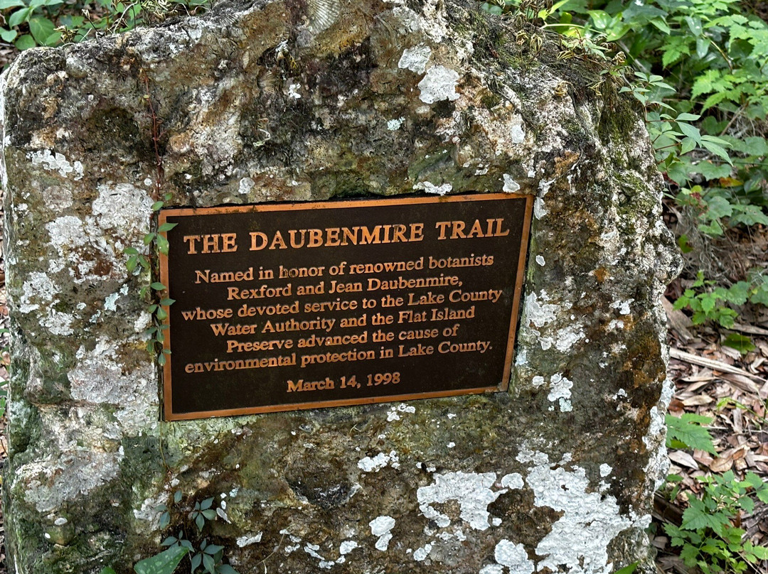
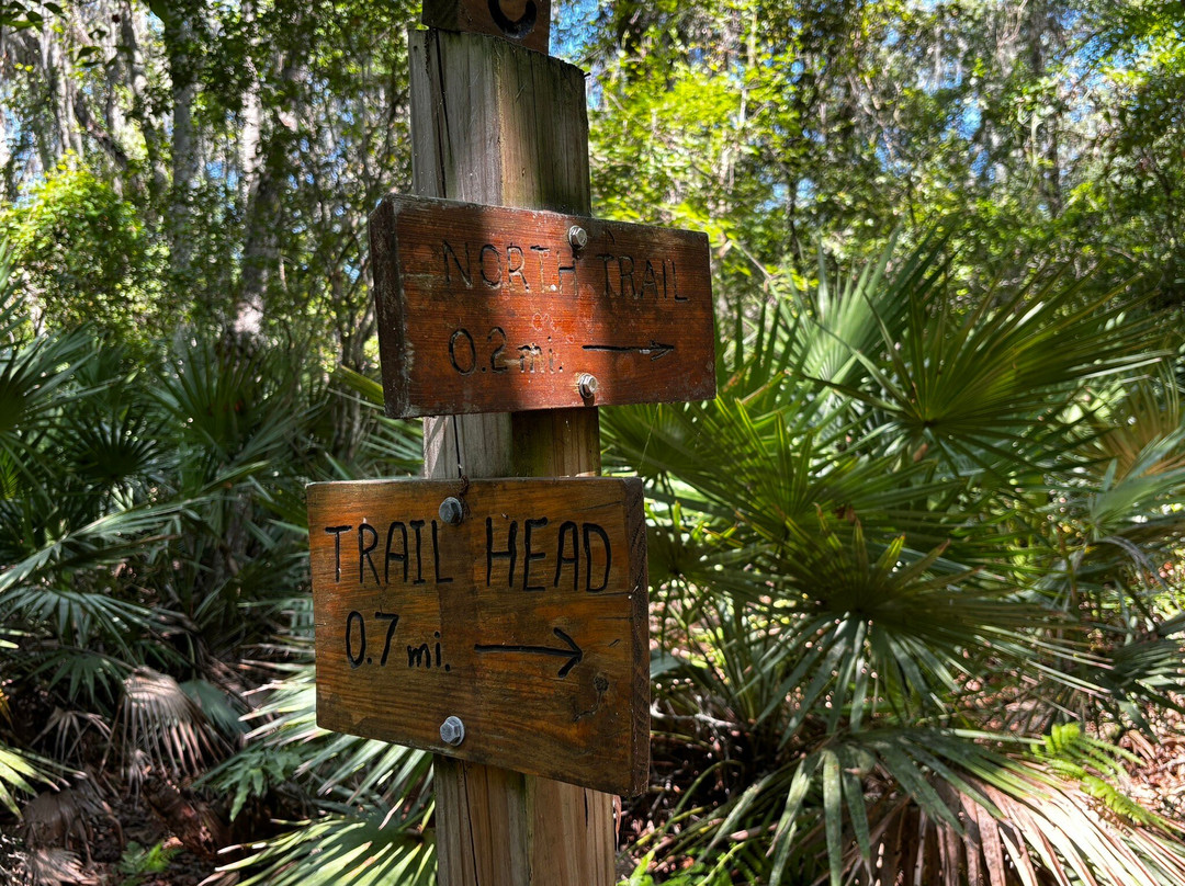
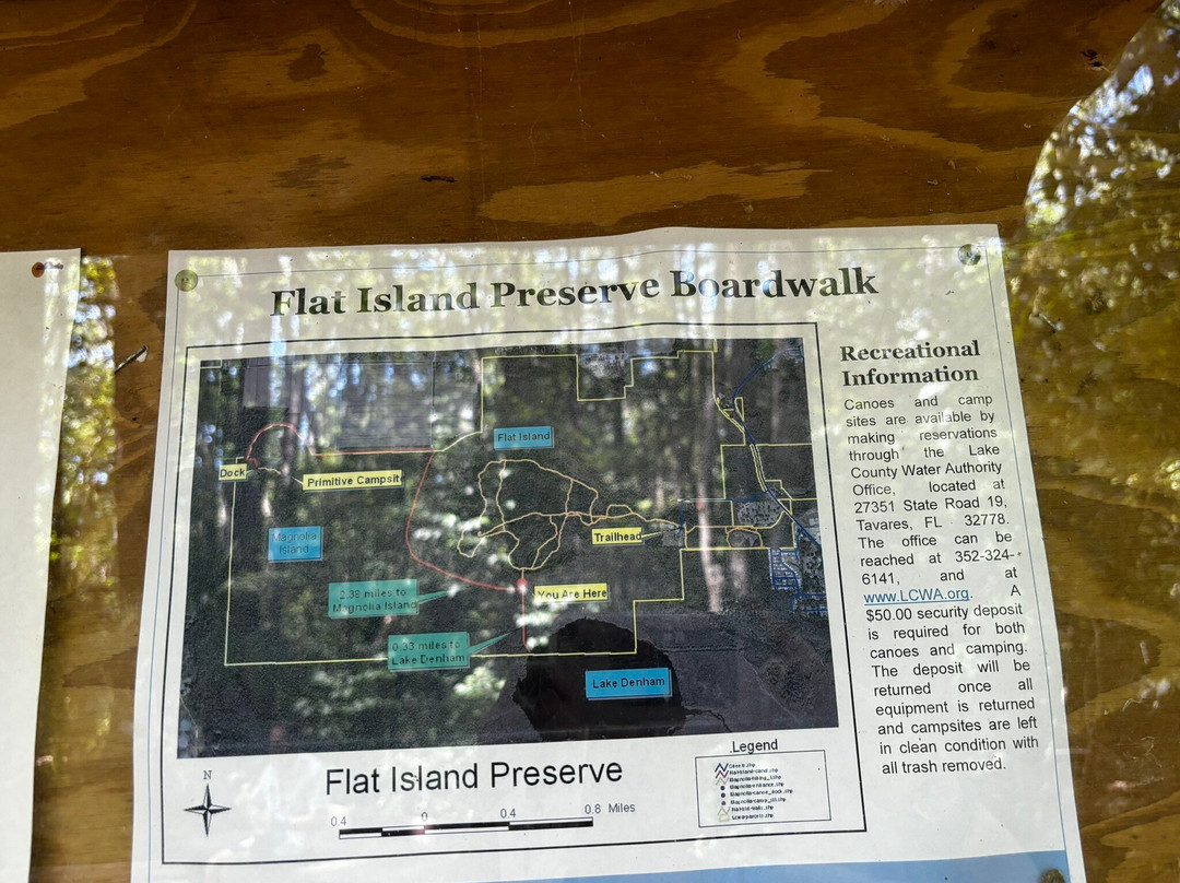
The four-mile (total) Daubenmire Trail is named in honor of botanists Rexford and Jean who performed the first botanical surveys and developed plant lists for Flat Island. The preserve is accessed on an unpaved dirt and sand road. As others have mentioned, visiting is best avoided after a significant rainfall when the road would be difficult to drive on; however, it does show signs of being graded.
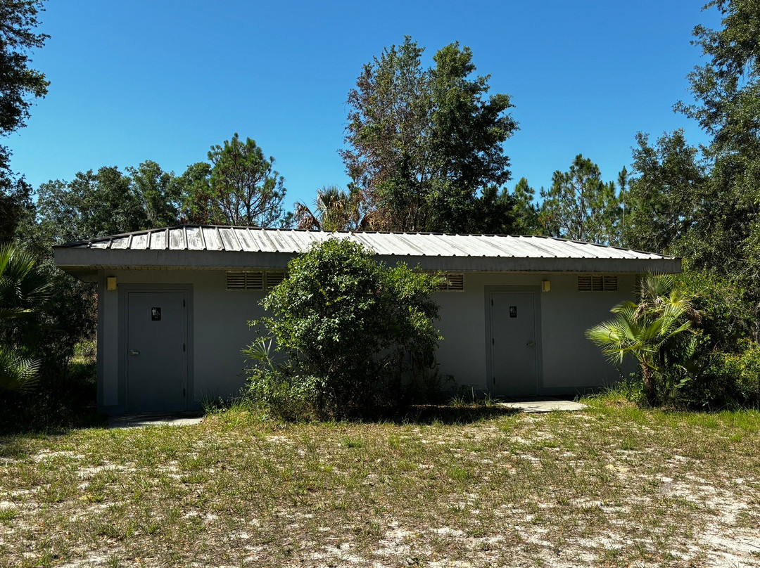
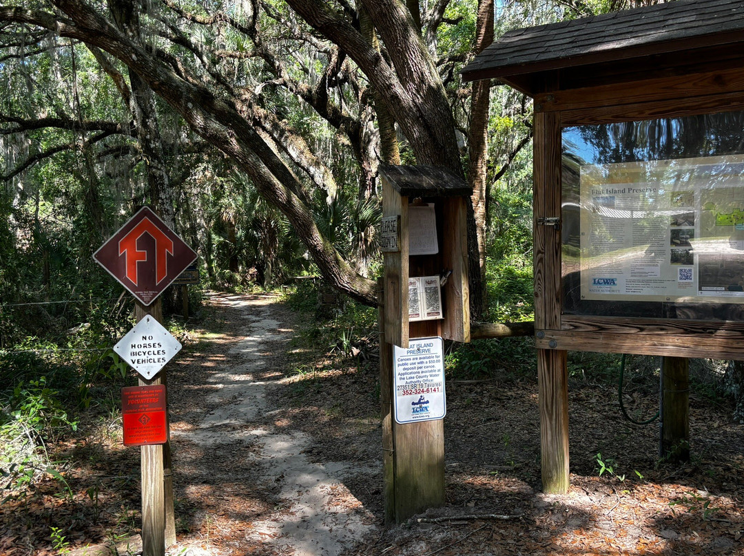
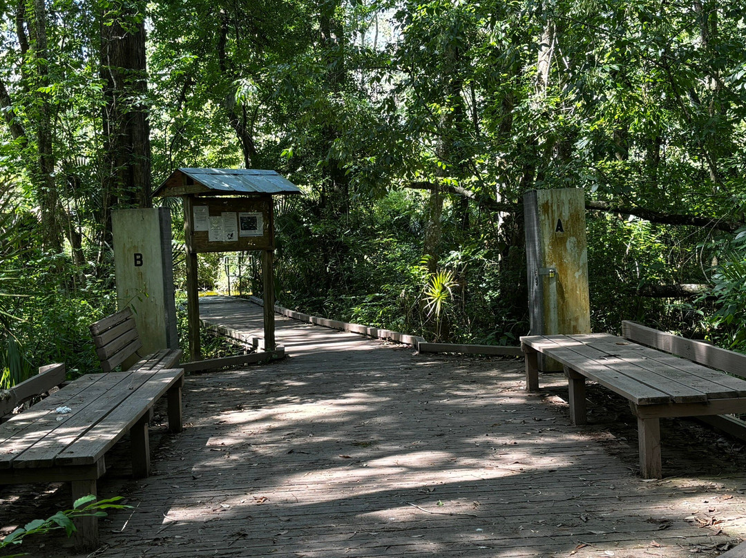
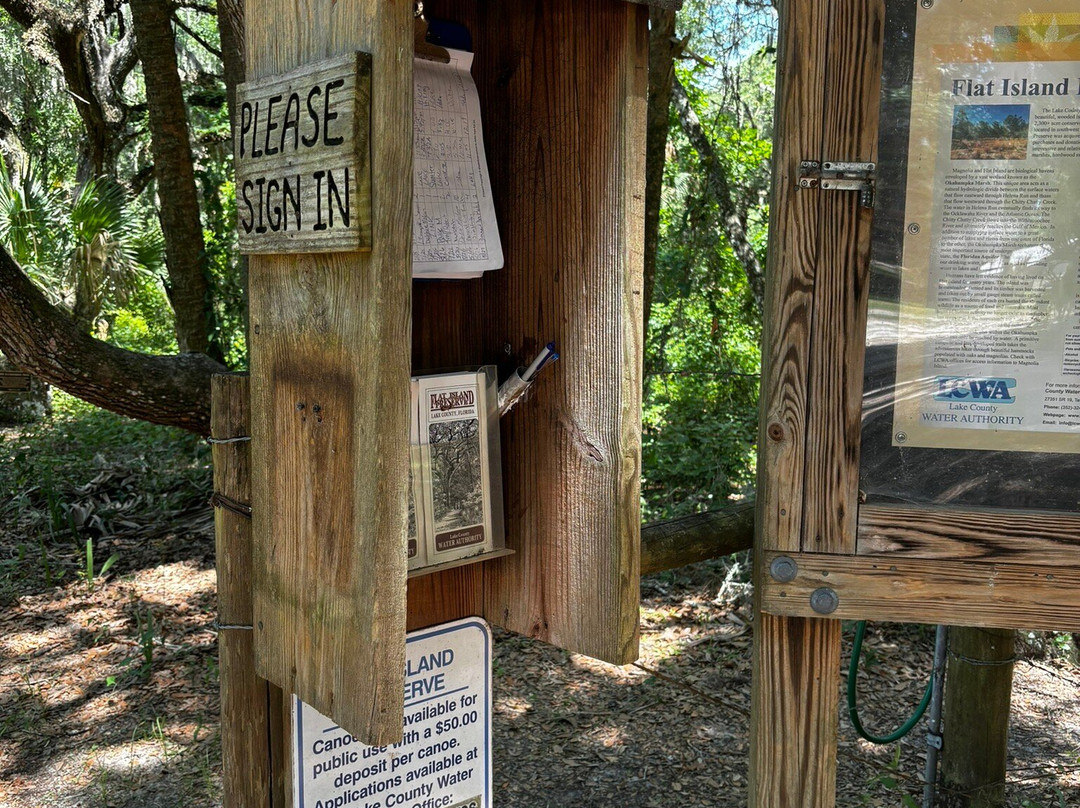
We were the only car in the parking lot mid-weekday morning. A cement block restroom building is at the trailhead; the clean restrooms have flush toilets with two stalls each. The group camping area is conveniently located adjacent to the parking lot and restroom building. Maps are available at the trailhead along with a sign-in/sign out sheet where a posted sign at the trailhead reminds visitors to both sign in and sign out. Only name, number in party and time in/out are requested.
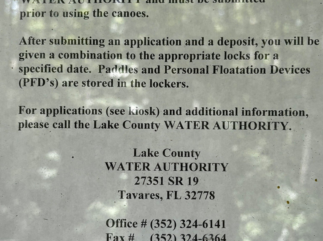
As others have noted, the preserve is not advised for anyone with mobility or balance issues. Tree roots are abundant and often concealed by fallen leaves. Sturdy shoes are as must! Pets are not allowed. Water is not available. Canoes, paddles and flotation vests are available by making prior arrangements through the LCWA office. Primitive camping is available for groups and backpackers by permit only at two locations within the Preserve.
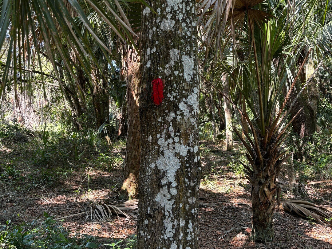
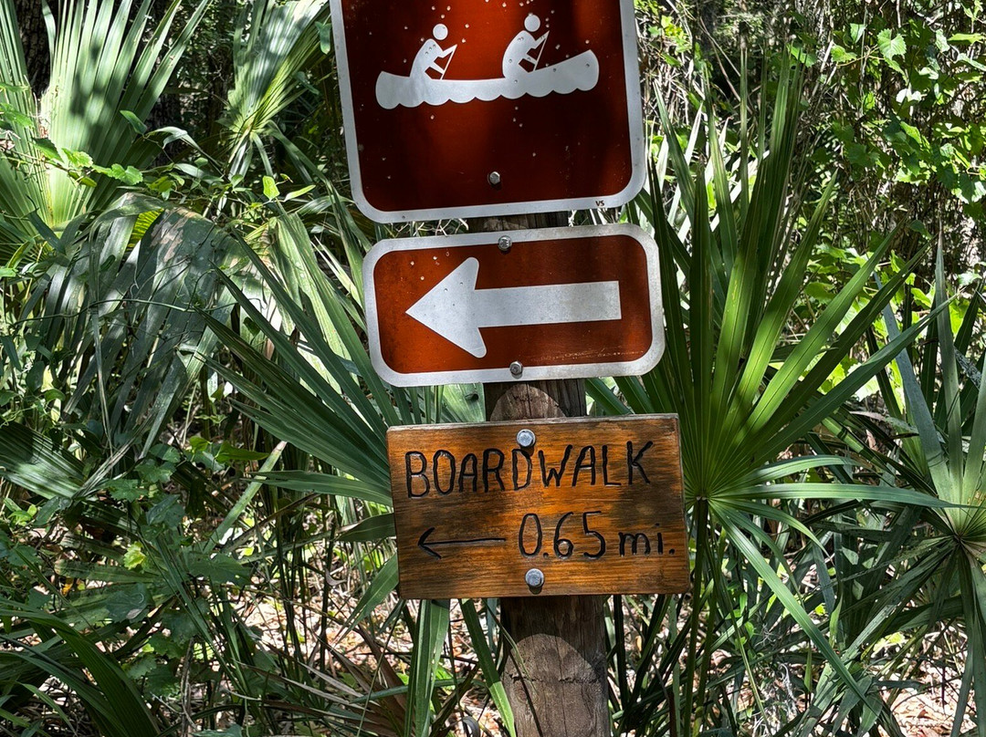
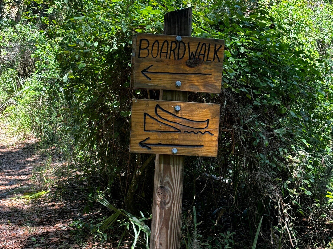
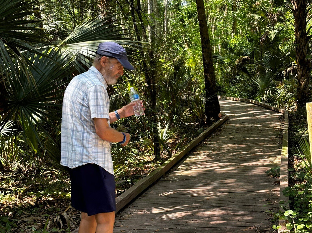
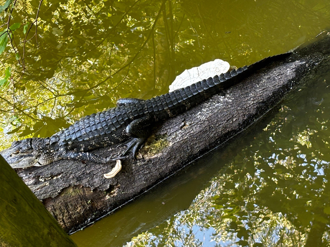
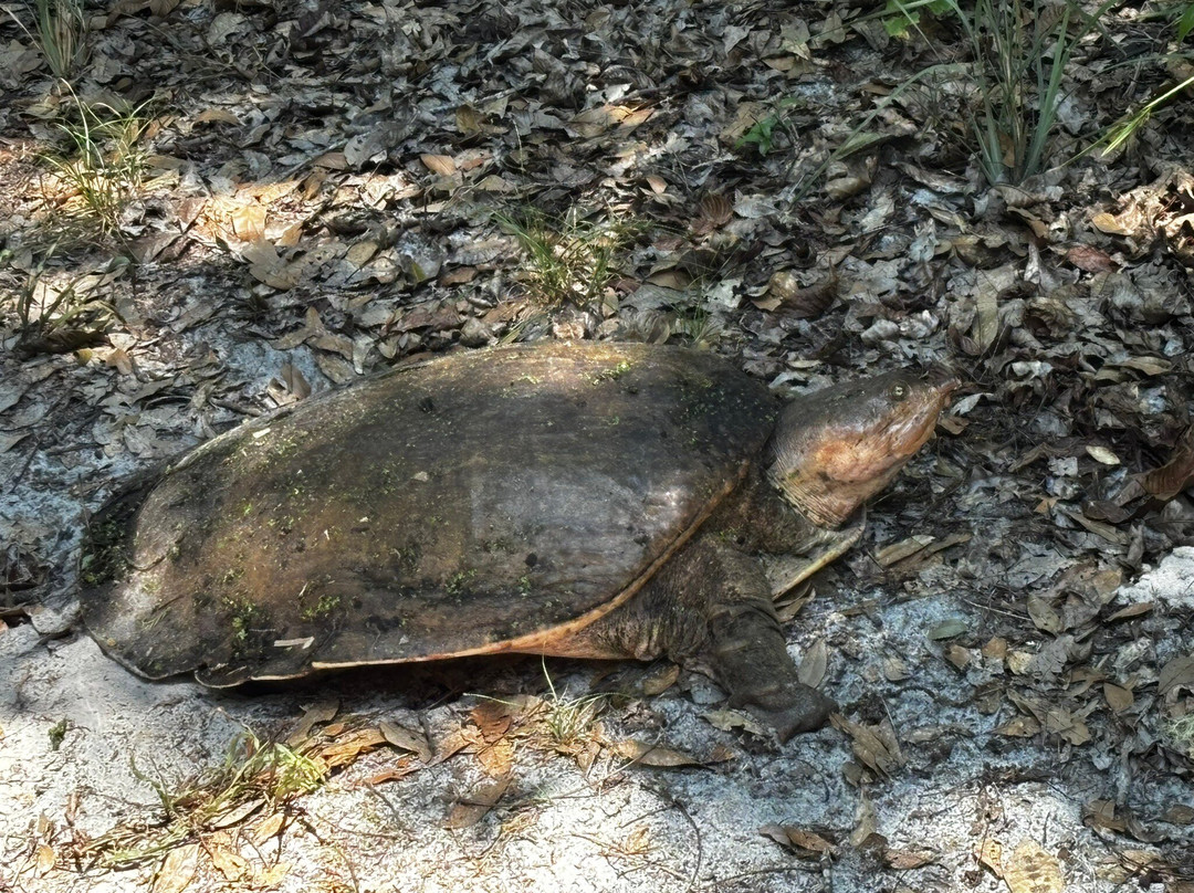
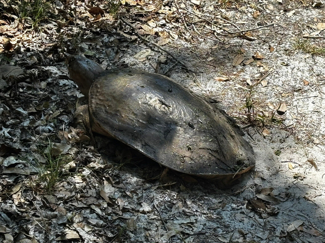
The trail we took is well marked with red blazes on the trees to provide direction. A service road cuts through the preserve; trails branch off to the north and south of the road clearly marked with markers A-F. The map is vital to maintain a sense of direction. We chose to follow the southern part of the trail system: markers A-E led us to the 440-foot long boardwalk and canoe landing area. Distances between the lettered markers are reasonable: .15 mi., .4 mi., 1.0 mi. and help when deciding how far you can walk. While spider webs were common, they were not annoying; we encountered very few mosquitoes mid-morning until we got to the canoe landing. There, we were rewarded with an alligator sunning itself on a log while giving us the side-eye. He had *not* been fed and exhibited no signs of aggression. On our return, we spotted a large Florida softshell turtle with its snorkel-like nose. We spent about a little more than an hour from start to finish and logged a little over 2 miles on an 86F morning with humidity at 44%. On our next visit, we will walk the northern section of the trail.
If you go: The preserve is open daily from sunrise until sunset; no charge to enter. Camping and canoeing are by permit only.
Not allowed: motorized vehicles, alcohol, pets and trapping devices, removal of plants, animals, archeological or cultural resources.
If you want to lose yourself in Old Florida and the natural world, and escape the noise and distractions of city life, Flat Island Preserve is your destination.
Located in Lake County off of Highway 27 in southwest Leesburg just north of Lake Denham, the preserve is maintained by the Lake County Water Authority which has preserved two wooded islands: Flat Island and Magnolia Island and the wetlands that surround them. The islands are known as Okahumpka Marsh which feeds the most important source of underground water in the state: the Floridian Aquifer.
The four-mile (total) Daubenmire Trail is named in honor of botanists Rexford and Jean who performed the first botanical surveys and developed plant lists for Flat Island. The preserve is accessed on an unpaved dirt and sand road. As others have mentioned, visiting is best avoided after a significant rainfall when the road would be difficult to drive on; however, it does show signs of being graded.
We were the only car in the parking lot mid-weekday morning. A cement block restroom building is at the trailhead; the clean restrooms have flush toilets with two stalls each. The group camping area is conveniently located adjacent to the parking lot and restroom building. Maps are available at the trailhead along with a sign-in/sign out sheet where a posted sign at the trailhead reminds visitors to both sign in and sign out. Only name, number in party and time in/out are requested.
As others have noted, the preserve is not advised for anyone with mobility or balance issues. Tree roots are abundant and often concealed by fallen leaves. Sturdy shoes are as must! Pets are not allowed. Water is not available. Canoes, paddles and flotation vests are available by making prior arrangements through the LCWA office. Primitive camping is available for groups and backpackers by permit only at two locations within the Preserve.
The trail we took is well marked with red blazes on the trees to provide direction. A service road cuts through the preserve; trails branch off to the north and south of the road clearly marked with markers A-F. The map is vital to maintain a sense of direction. We chose to follow the southern part of the trail system: markers A-E led us to the 440-foot long boardwalk and canoe landing area. Distances between the lettered markers are reasonable: .15 mi., .4 mi., 1.0 mi. and help when deciding how far you can walk. While spider webs were common, they were not annoying; we encountered very few mosquitoes mid-morning until we got to the canoe landing. There, we were rewarded with an alligator sunning itself on a log while giving us the side-eye. He had *not* been fed and exhibited no signs of aggression. On our return, we spotted a large Florida softshell turtle with its snorkel-like nose. We spent about a little more than an hour from start to finish and logged a little over 2 miles on an 86F morning with humidity at 44%. On our next visit, we will walk the northern section of the trail.
If you go: The preserve is open daily from sunrise until sunset; no charge to enter. Camping and canoeing are by permit only.
Not allowed: motorized vehicles, alcohol, pets and trapping devices, removal of plants, animals, archeological or cultural resources.
If you want to lose yourself in Old Florida and the natural world, and escape the noise and distractions of city life, Flat Island Preserve is your destination.
翻译:我在当地报纸上读到了关于平岛保护区的报道,它被描述为一个在森林和小径中训练长途徒步的当地地方。我们住在佛罗里达州利斯堡附近,在城市中心一个安静的保护区里散步的想法让我们很感兴趣。我们出发了。
保护区位于莱克县 27 号公路旁,利斯堡西南部,丹汉湖以北,由莱克县水务局维护,该局保护了两个树木繁茂的岛屿:平岛和木兰岛以及周围的湿地。这两个岛屿被称为 Okahumpka 沼泽,为该州最重要的地下水源:佛罗里达含水层提供水源。
四英里(总长)的 Daubenmire 小径以植物学家 Rexford 和 Jean 的名字命名,他们进行了第一次植物调查并为平岛制定了植物名录。保护区可通过一条未铺砌的土路和沙路进入。正如其他人提到的,最好避免在大雨后前往,因为那时道路难以通行;但是,它确实显示出被分级的迹象。
我们是工作日上午停车场里唯一的汽车。小径入口处有一座水泥砌块卫生间;干净的卫生间有抽水马桶,每个马桶有两个隔间。团体露营区位置便利,毗邻停车场和卫生间。小径入口处有地图以及签到/签出表,小径入口处张贴的标志提醒游客签到和签出。只需要姓名、团体人数和进出时间。
正如其他人所说,保护区不建议行动不便或平衡有问题的人进入。树根丰富,经常被落叶遮住。必须穿结实的鞋子!不允许携带宠物。没有水。可通过 LCWA 办公室提前安排提供独木舟、桨和救生衣。保护区内的两个地点只为团体和背包客提供原始露营许可。
我们走的路有明显的标记,树上有红色火焰,可以指引方向。一条服务道路穿过保护区;小径从道路的北面和南面分叉,清晰地标有 A-F 标记。地图对于保持方向感至关重要。我们选择沿着小径系统的南部行走:标记 A-E 将我们带到 440 英尺长的木板路和独木舟登陆区。字母标记之间的距离是合理的:0.15 英里、0.4 英里、1.0 英里,有助于决定您可以走多远。虽然蜘蛛网很常见,但它们并不烦人;上午中旬,直到我们到达独木舟登陆处,我们遇到的蚊子很少。在那里,我们看到了一只鳄鱼在木头上晒太阳,同时斜眼看着我们。它没有吃东西,也没有表现出攻击性。在我们回来的路上,我们发现了一只大佛罗里达软壳龟,它的鼻子像通气管一样。我们从开始到结束花了大约一个多小时,在 86 华氏度的早晨,湿度为 44%,走了 2 英里多一点。下次访问时,我们将步行小径的北段。
如果您要去:保护区每天从日出到日落开放;免费进入。露营和划独木舟必须凭许可证。
禁止:机动车辆、酒精、宠物和诱捕装置、移除植物、动物、考古或文化资源。
如果您想沉浸在老佛罗里达和自然世界中,逃离城市生活的喧嚣和干扰,Flat Island 保护区就是您的目的地。


© 2026 Tripadvisor 版权所有。
部分照片由 VFM Leonardo 提供。
TripAdvisor公司对外部网站的内容一概不负责。优惠价格中不含税和其他费用。
ICP证:沪B2-20200433
沪ICP备20013175号
 沪公网安备31010502005427号
鹰程信息技术(上海)有限公司