
下载App
资质规则
旅行
账户

Peter Š
One of the first suburbs to be linked by rail to the metropolitan city. Imagine life on the beach >140 years ago.
Green Point的点评
点评:Review of Green Point, Foreshore Reserve, Esplanade, Brighton, Vic
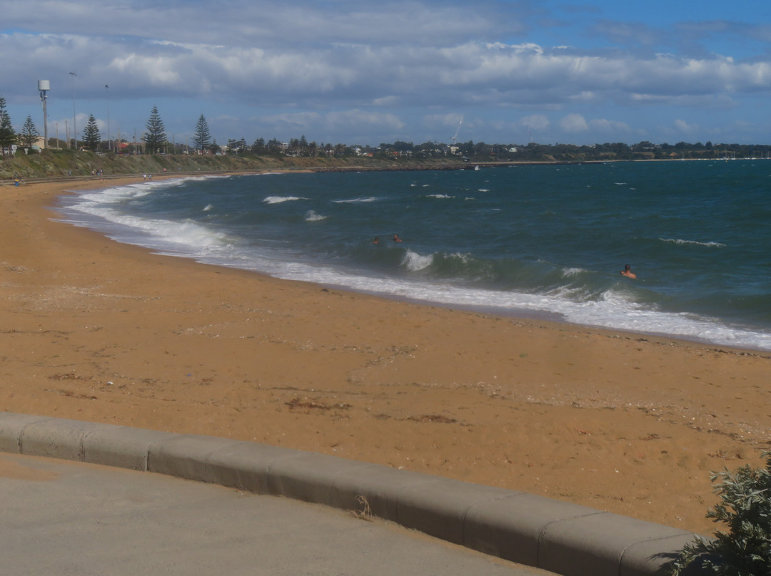
Remembering back, we’re certain that one time we’d visited the Foreshore Reserve to watch the fireworks display in the night sky over Metropolitan Melbourne on New Years Eve; time, unfortunately, has this devious characteristic of running away with distant memories. It was late afternoon, however and the reserve, beach and surrounding country seemed empty. There was no one on Brighton Beach and no one in the water. Late afternoon and it was cold with cloud cover.
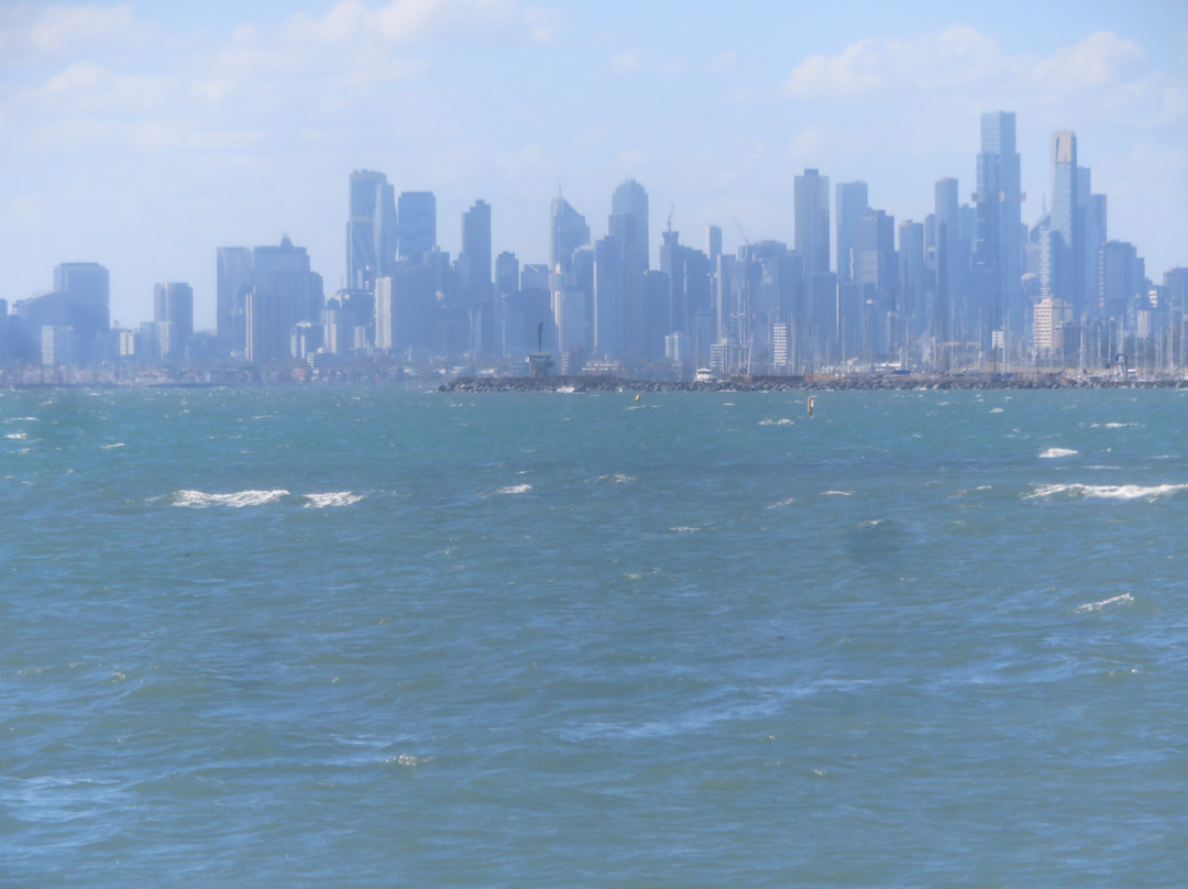
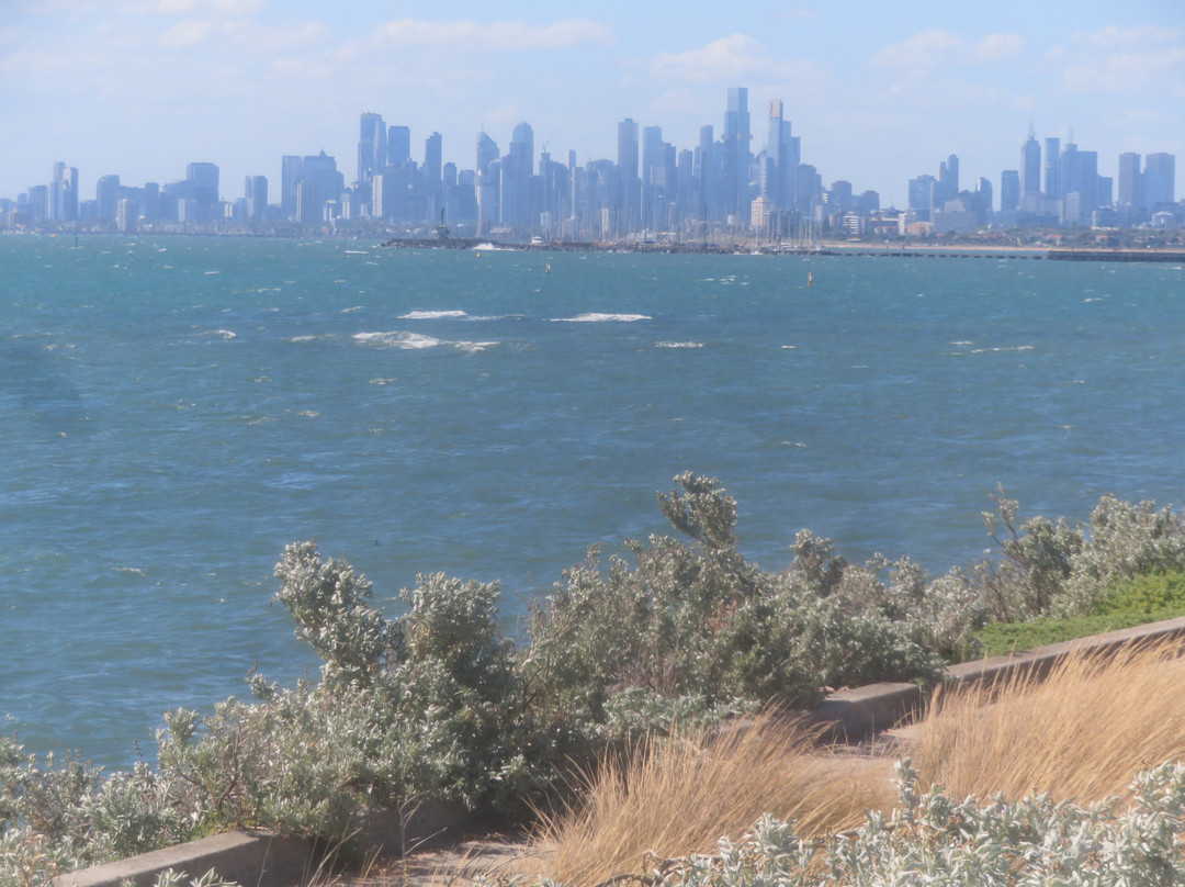
For once, however, we had time in hand following an appointment in Brighton that afternoon - we figured to walk along the footpath above the beach between the bay and the Esplanade to catch the images of the seascape and the western bay shoreline in the far distance. Walk north and there were those distant glimpses of high-rise buildings in the CDB 14 km away.
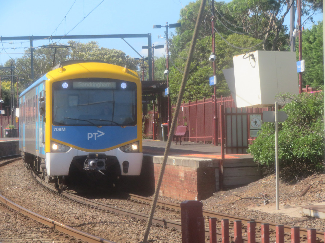
Green Point is at the edge of an extensive car park in the south of the reserve. We’d left our car, however, parked in front of short row of shops adjacent to the Sandringham Metro line where it exits/enters Brighton Beach Station at the bay end of South Road. Next to the shops there’s a gated footpath/level crossing that enables people and road traffic to cross the rail line.
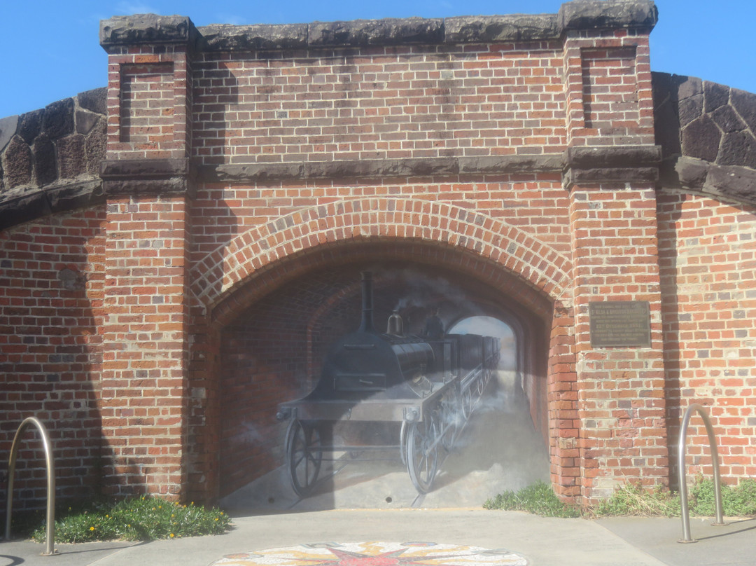
We followed the pavement, crossed South Road on the signal and followed at right angles by Beach Road and more signals and entered the narrow Brighton Beach Foreshore Reserve. Walking north from there with the bay on our left - there, on the right to one side - is a small (and abandoned/lost/demolished) railway tunnel that seems to form part of the surrounding foundation of the Esplanade – there’s only a two-dimensional structure visible with the tunnel section filled with a board showing the image of a mid-19th C. steam locomotive hauling four open railway trucks and heading straight towards you. You’re standing where the rails would be.
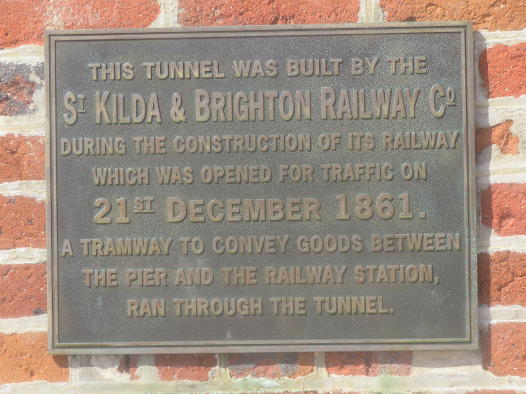
There’s a plate attached to the tunnel that describes the original purpose – a freight route for a tramway that carried goods between the pier and the railway station. It was built by the St. Kilda & Brighton Railway Co. and opened 21 Dec 1861- more than 160 years ago. Imagine. The beach finishes about 200 m passed the tunnel and the path takes a sharp turn to the right and follows the sea wall of the Foreshore Reserve. Scramble up the sloping wall and you’re in the car park.
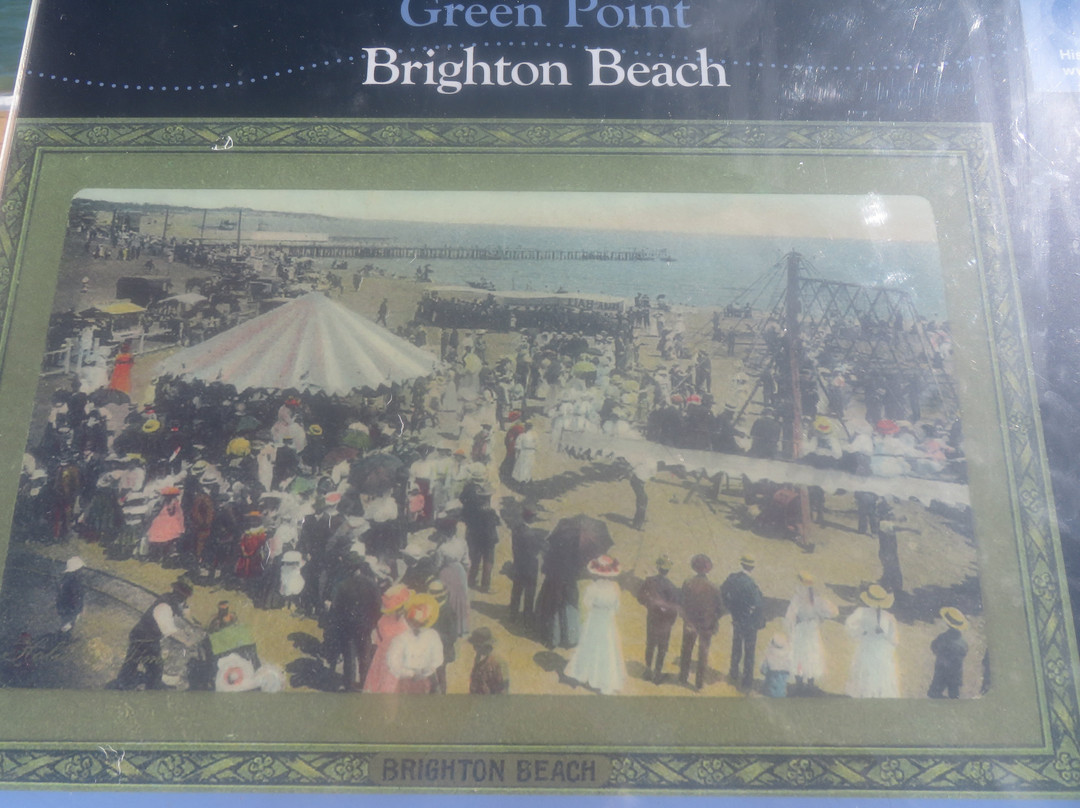
On your right there’s a small three-quarters circular paved area on the corner overlooking the bay. Inside there’s a handful of poster places with descriptive text/images on some of them. One poster contained the image of an early photo that easily dates back to those Marvellous Melbourne times late 19th C. when the real estate in St Kilda & Brighton was the focus of investment, fine properties, entertainment, people with personalities. etc. and with a reputation to match. It was joined to the city be a new railway.
The photo shows Brighton Beach with crowds of people in all their finery seated and/or standing around in groups. Some are watching rudimentary fairground activities – swings and roundabout. Stalls and vehicles behind a fence line the road nearby and, in the background, is a pier. (Presumably, the same one served by the tramway. In the photo the pier crosses the beach about 400 m away – south of Green Point. It no longer exists.)
Clearly, these were early days for those novel sea-bathing activities that were being explored across the industrial world) including segregated bathing, bathing huts, full cover swim wear and similar; you needed to be wealthy – and adventurous – to participate. In the picture the people are fully clothed and there is no one in the sea.
Peter Steele
18 February 2025
Remembering back, we’re certain that one time we’d visited the Foreshore Reserve to watch the fireworks display in the night sky over Metropolitan Melbourne on New Years Eve; time, unfortunately, has this devious characteristic of running away with distant memories. It was late afternoon, however and the reserve, beach and surrounding country seemed empty. There was no one on Brighton Beach and no one in the water. Late afternoon and it was cold with cloud cover.
For once, however, we had time in hand following an appointment in Brighton that afternoon - we figured to walk along the footpath above the beach between the bay and the Esplanade to catch the images of the seascape and the western bay shoreline in the far distance. Walk north and there were those distant glimpses of high-rise buildings in the CDB 14 km away.
Green Point is at the edge of an extensive car park in the south of the reserve. We’d left our car, however, parked in front of short row of shops adjacent to the Sandringham Metro line where it exits/enters Brighton Beach Station at the bay end of South Road. Next to the shops there’s a gated footpath/level crossing that enables people and road traffic to cross the rail line.
We followed the pavement, crossed South Road on the signal and followed at right angles by Beach Road and more signals and entered the narrow Brighton Beach Foreshore Reserve. Walking north from there with the bay on our left - there, on the right to one side - is a small (and abandoned/lost/demolished) railway tunnel that seems to form part of the surrounding foundation of the Esplanade – there’s only a two-dimensional structure visible with the tunnel section filled with a board showing the image of a mid-19th C. steam locomotive hauling four open railway trucks and heading straight towards you. You’re standing where the rails would be.
There’s a plate attached to the tunnel that describes the original purpose – a freight route for a tramway that carried goods between the pier and the railway station. It was built by the St. Kilda & Brighton Railway Co. and opened 21 Dec 1861- more than 160 years ago. Imagine. The beach finishes about 200 m passed the tunnel and the path takes a sharp turn to the right and follows the sea wall of the Foreshore Reserve. Scramble up the sloping wall and you’re in the car park.
On your right there’s a small three-quarters circular paved area on the corner overlooking the bay. Inside there’s a handful of poster places with descriptive text/images on some of them. One poster contained the image of an early photo that easily dates back to those Marvellous Melbourne times late 19th C. when the real estate in St Kilda & Brighton was the focus of investment, fine properties, entertainment, people with personalities. etc. and with a reputation to match. It was joined to the city be a new railway.
The photo shows Brighton Beach with crowds of people in all their finery seated and/or standing around in groups. Some are watching rudimentary fairground activities – swings and roundabout. Stalls and vehicles behind a fence line the road nearby and, in the background, is a pier. (Presumably, the same one served by the tramway. In the photo the pier crosses the beach about 400 m away – south of Green Point. It no longer exists.)
Clearly, these were early days for those novel sea-bathing activities that were being explored across the industrial world) including segregated bathing, bathing huts, full cover swim wear and similar; you needed to be wealthy – and adventurous – to participate. In the picture the people are fully clothed and there is no one in the sea.
Peter Steele
18 February 2025
翻译:维多利亚州布莱顿滨海公园绿点点评
回想起来,我们确信有一次在新年前夕我们曾到滨海公园观看墨尔本大都会夜空中的烟花表演;不幸的是,时间总是带着遥远的记忆溜走。然而,当时已是傍晚,公园、海滩和周围的乡村似乎空无一人。布莱顿海滩上空无一人,水中也没有人。傍晚时分,天气寒冷,云层密布。
然而,那天下午我们在布莱顿有一个约会,所以有时间——我们打算沿着海湾和滨海公园之间的海滩上方的人行道散步,拍下远处海景和西湾海岸线的照片。向北走,14 公里外的 CDB 上可以瞥见远处的高楼大厦。
绿点位于公园南部一个大型停车场的边缘。然而,我们把车停在桑德灵厄姆地铁线旁边的一排商店前,地铁线从那里驶出/驶入南路海湾尽头的布莱顿海滩站。商店旁边有一条有门的人行道/平交道,行人和道路车辆可以穿过铁路线。
我们沿着人行道,在信号灯处穿过南路,然后直角地经过海滩路和更多的信号灯,进入狭窄的布莱顿海滩滨海保护区。从那里向北走,左边是海湾——在那里,右边的一侧——是一条小的(废弃/丢失/拆除的)铁路隧道,似乎是滨海艺术中心周围地基的一部分——只有一个二维结构可见,隧道部分装满了一块板,上面画着一辆 19 世纪中期的蒸汽机车,它拖着四辆敞篷火车车厢,径直朝你驶来。你站在铁轨所在的地方。
隧道上附有一块铭牌,上面描述了隧道的最初用途——一条有轨电车货运路线,用于在码头和火车站之间运送货物。隧道由圣基尔达和布莱顿铁路公司建造,于 1861 年 12 月 21 日开通,距今已有 160 多年。想象一下。穿过隧道后约 200 米就是海滩,小路向右急转,沿着前滨保护区的海堤前行。爬上倾斜的墙壁,你就到了停车场。
在你的右边,拐角处有一个四分之三圆形的小铺砌区域,可以俯瞰海湾。里面有一些海报,其中一些上面有描述性文字/图片。一张海报上有一张早期的照片,很容易追溯到 19 世纪末那些奇妙的墨尔本时代,当时圣基尔达和布莱顿的房地产是投资、优质房产、娱乐、有个性的人等的焦点,并享有相应的声誉。它通过一条新铁路与城市相连。
照片显示布莱顿海滩上,一群身着华丽服饰的人成群结队地坐着或站着。有些人正在观看基本的游乐场活动——秋千和旋转木马。围栏后面的摊位和车辆排列在附近的道路上,背景是一座码头。(据推测,就是有轨电车服务的那个码头。照片中的码头横跨约 400 米外的海滩——位于绿点以南。它已不复存在。)
显然,这是工业世界正在探索的那些新奇的海水浴活动的早期阶段)包括隔离沐浴、沐浴小屋、全罩式泳衣等;你需要富有——并且富有冒险精神——才能参与。照片中的人们穿着整齐,海里没有人。
Peter Steele
2025 年 2 月 18 日

© 2026 Tripadvisor 版权所有。
部分照片由 VFM Leonardo 提供。
TripAdvisor公司对外部网站的内容一概不负责。优惠价格中不含税和其他费用。
ICP证:沪B2-20200433
沪ICP备20013175号
 沪公网安备31010502005427号
鹰程信息技术(上海)有限公司