下载App
资质规则
旅行
账户

LoriA851
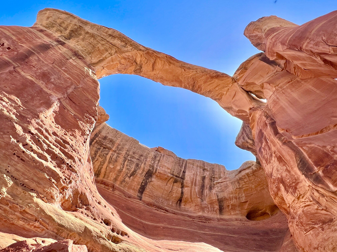
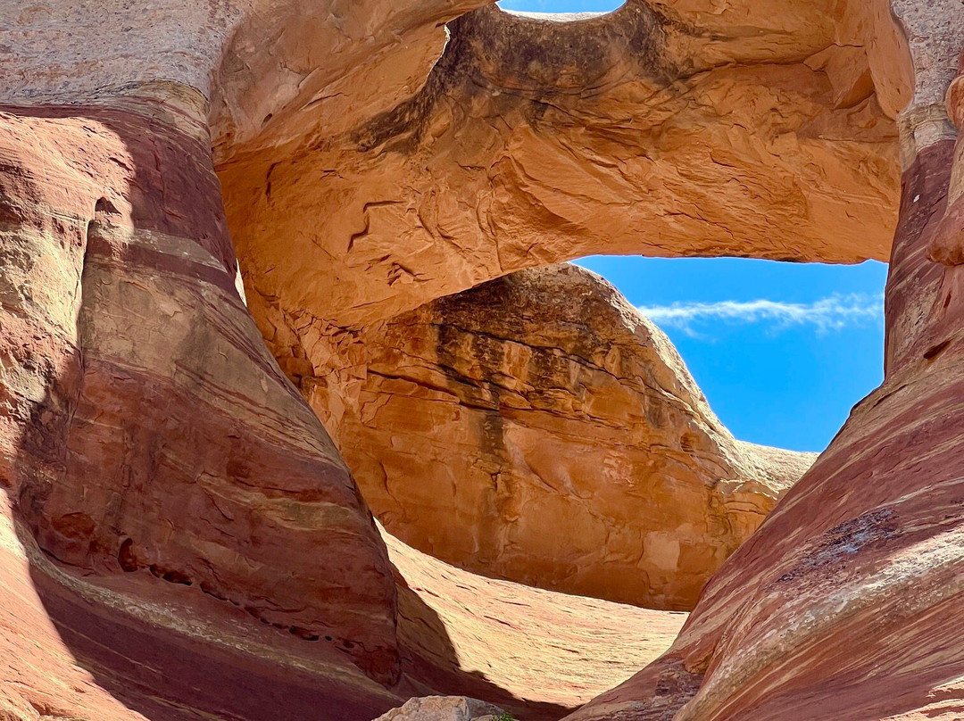
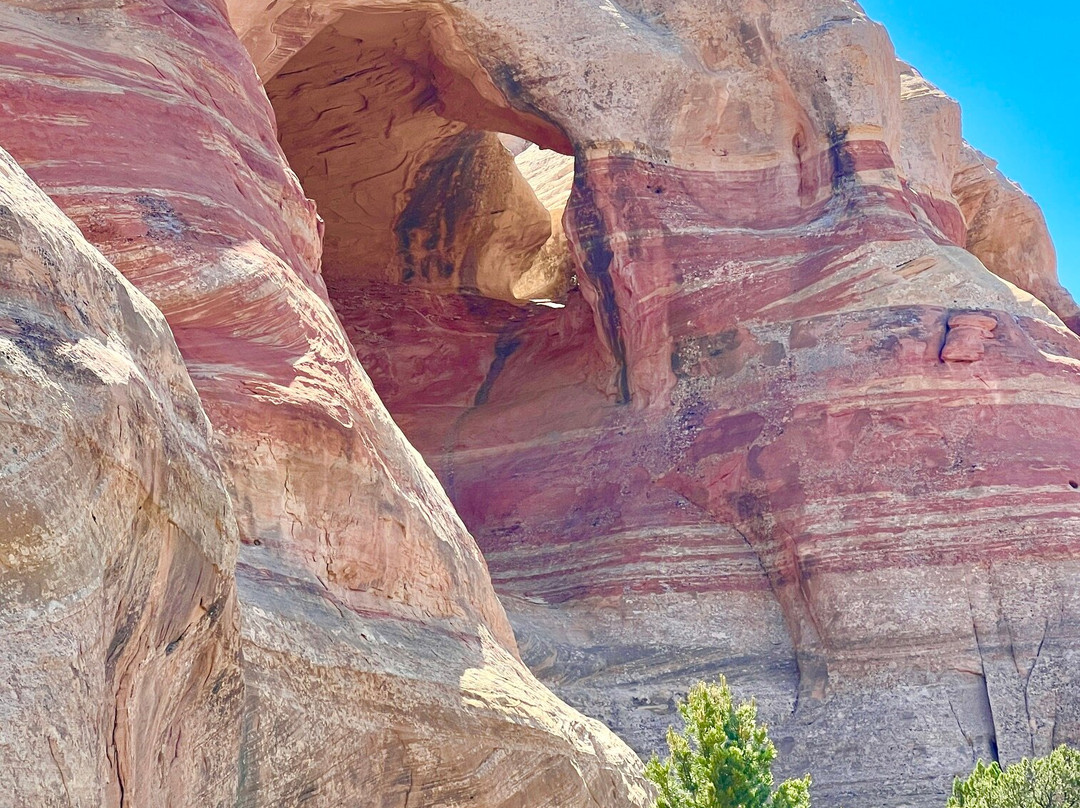
Great remote 9 arches hike experience!!
Rattlesnake Canyon的点评
点评:A beautiful & remote place, saw about 8 people in 4 hours...but beware the driving part of the road is gnarly! Beginning mile is bad, then it's smooth driving for about half hour, then rough steps of rock and steep at the last 2 miles. Total of 1.5 hours drive, about 8 miles. There's a sign at the top of the last 2 miles letting you know you're near the end of the drive. Drive all the way down the last 2 miles only if you've got a jeep or high clearance, we had a 4 runner and it was fine, (otherwise add 4 miles round to your trip if you're in a sedan and choose to hike it) And never drive it if it's going to rain. (Bentonite clay slippery and were told you'd get stuck!)
Once at the bottom of the road, the trailhead has options. The trail to take is the lower, to see about 9 arches in a 5.5 mile hike. About 400 hundred ft elevation loss/gain at the beginning of the trail, steep... But the trail is flat otherwise. We were told if you wanted it to be a loop (and not an out and back) you'd have to climb up the last arch which is crazy hard/steep, not to try it. So it's out and back. If you do the top shorter trail, you won't see all the arches, so not recommended. Get the Black Ridge Canyons wildnerness map and guide from the guard house or visitor center on the way into Colorado N'tl Monument so you have the info. Some people hike 14 miles round from another area, this is the shortest way to hike it. Great experience!!
Once at the bottom of the road, the trailhead has options. The trail to take is the lower, to see about 9 arches in a 5.5 mile hike. About 400 hundred ft elevation loss/gain at the beginning of the trail, steep... But the trail is flat otherwise. We were told if you wanted it to be a loop (and not an out and back) you'd have to climb up the last arch which is crazy hard/steep, not to try it. So it's out and back. If you do the top shorter trail, you won't see all the arches, so not recommended. Get the Black Ridge Canyons wildnerness map and guide from the guard house or visitor center on the way into Colorado N'tl Monument so you have the info. Some people hike 14 miles round from another area, this is the shortest way to hike it. Great experience!!
翻译:这是一个风景优美却又人迹罕至的地方,我们在4个小时里只遇到了大约8个人……但要注意,这段路的路况非常糟糕!开头一英里路况很差,之后大约半小时路段比较平坦,最后两英里则是崎岖不平的岩石路段,而且非常陡峭。全程大约需要1.5小时,8英里。在最后两英里的尽头有一个路标,提示你即将到达终点。只有开吉普车或底盘较高的车辆才能一路开到最后两英里,我们开的是丰田4Runner,感觉还不错。(如果你开的是轿车,那就得在行程中增加4英里,选择徒步。)如果下雨,千万不要开车。(据说膨润土路面很滑,很容易陷进去!)
到达路的尽头后,步道起点有几条路线可以选择。建议选择较低的那条,这条5.5英里的徒步路线可以看到大约9个拱门。步道起点处海拔落差约400英尺(约120米),坡度陡峭……但除此之外,步道平坦。我们被告知,如果想走环线(而不是原路返回),就必须爬上最后一个拱门,那非常难爬/非常陡,不建议尝试。所以只能原路返回。如果走上面那条较短的步道,就看不到所有的拱门,所以不推荐。建议在进入科罗拉多国家纪念碑的路上,从警卫室或游客中心领取黑岭峡谷荒野地图和指南,以便获取相关信息。有些人从其他地方徒步往返14英里(约22.5公里),这条路线是最短的。非常棒的体验!
到达路的尽头后,步道起点有几条路线可以选择。建议选择较低的那条,这条5.5英里的徒步路线可以看到大约9个拱门。步道起点处海拔落差约400英尺(约120米),坡度陡峭……但除此之外,步道平坦。我们被告知,如果想走环线(而不是原路返回),就必须爬上最后一个拱门,那非常难爬/非常陡,不建议尝试。所以只能原路返回。如果走上面那条较短的步道,就看不到所有的拱门,所以不推荐。建议在进入科罗拉多国家纪念碑的路上,从警卫室或游客中心领取黑岭峡谷荒野地图和指南,以便获取相关信息。有些人从其他地方徒步往返14英里(约22.5公里),这条路线是最短的。非常棒的体验!

© 2026 Tripadvisor 版权所有。
部分照片由 VFM Leonardo 提供。
TripAdvisor公司对外部网站的内容一概不负责。优惠价格中不含税和其他费用。
ICP证:沪B2-20200433
沪ICP备20013175号
 沪公网安备31010502005427号
鹰程信息技术(上海)有限公司